

Live Update  From the Liveblog of
Sunday, June 22, 2025
From the Liveblog of
Sunday, June 22, 2025
From the Liveblog of
Sunday, June 22, 2025
Fresh satellite images show damage at Fordo nuclear site after US strikes
 Add ToI as a Preferred Source on Google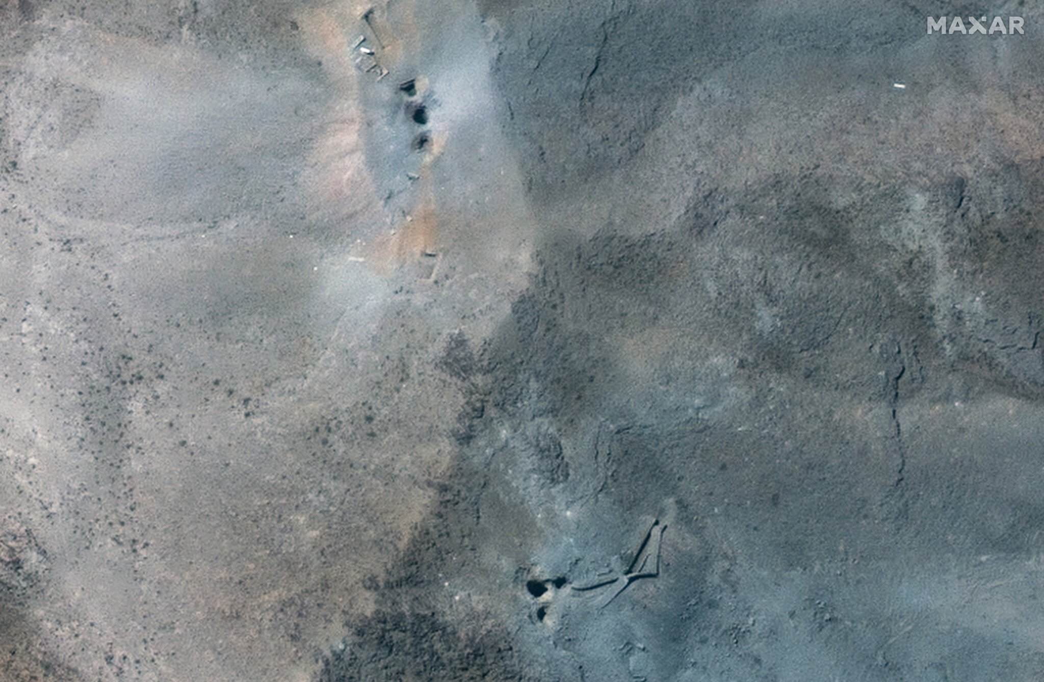
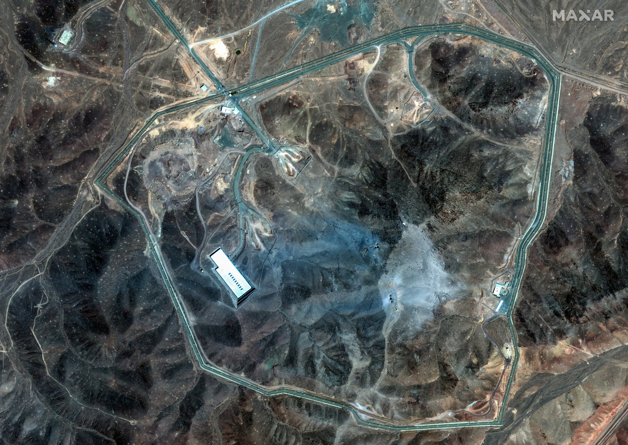
This handout satellite picture provided by Maxar Technologies and taken on June 22, 2025, shows Iran's Fordo Fuel Enrichment Plant (FFEP), northeast of the city of Qom, after US strikes on the site. (Satellite image ©2025 Maxar Technologies / AFP)
Additional satellite images show damage on the mountainside at Iran’s underground Fordo nuclear site after US airstrikes targeted the facility.
The images by Maxar show at least six holes on the mountain, where the massive 30,000-pound GBU-57 Massive Ordnance Penetrator bombs, dropped from B-2 stealth bombers, impacted.
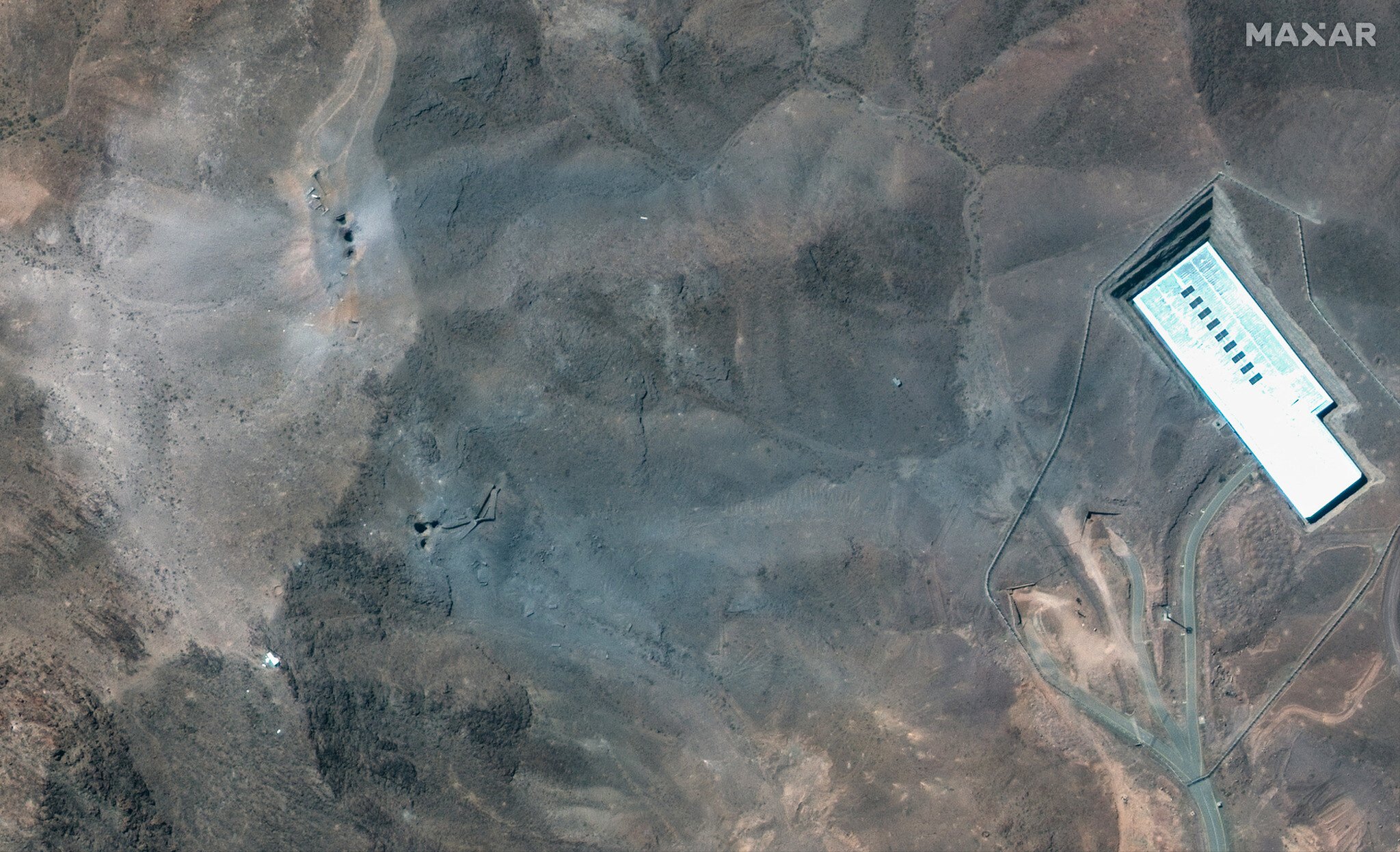
The “bunker buster” bomb is believed to be able to penetrate about 200 feet (61 meters) below the surface before exploding.
Iran has yet to offer a damage assessment of the site.








If you’d like to comment, join
The Times of Israel Community.
The Times of Israel Community.
JOIN THE TOI COMMUNITY
Already a member? Log in here