

Live Update  From the Liveblog of
Wednesday, August 5, 2020
From the Liveblog of
Wednesday, August 5, 2020
From the Liveblog of
Wednesday, August 5, 2020
Israeli firm releases satellite photos of Beirut blast aftermath
 Add ToI as a Preferred Source on Google
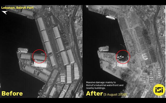
An Israeli satellite imagery analysis firm releases fresh bird’s-eye images of the damage caused by yesterday’s massive explosions at the Beirut Port.
The photographs show that the blasts caused a 70-meter (230-foot) crater near the port, leveling the buildings immediately surrounding the site, and directly damaging structures up to two kilometers (1.2 miles) away.
In one of the photos, a boat can be seen on its side after being knocked over by the force of the blast.
— Judah Ari Gross







If you’d like to comment, join
The Times of Israel Community.
The Times of Israel Community.
JOIN THE TOI COMMUNITY
Already a member? Log in here