

Newly released satellite images show damage dealt in Iran war across Middle East
Photos from first days of war reveal ships ablaze in Iran, military buildings destroyed in Abu Dhabi, and a fire at the world’s busiest airport for international travel in Dubai
 Add ToI as a Preferred Source on Google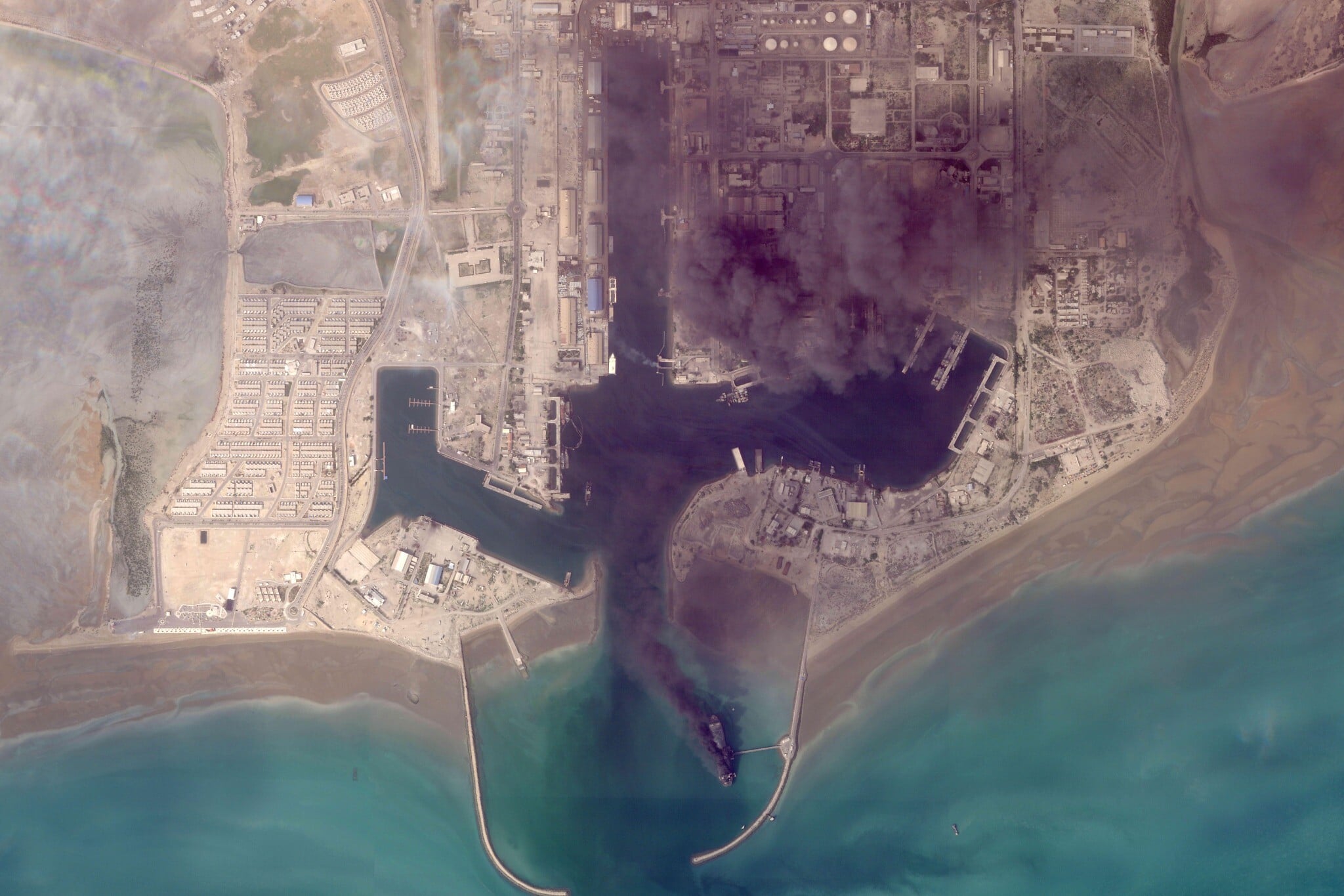
DUBAI, United Arab Emirates (AP) — Satellite images, newly released, are beginning to show a glimpse of the toll of the Iran war, with ships ablaze in an Iranian port and destroyed buildings at an American base.
Information has so far been scarce about the damage being done across the Middle East since the start of the war on February 28, particularly when it’s inside closed military facilities.
The images come from Planet Labs PBC, a US-based firm used by media outlets, including The Associated Press. Planet Labs has put a two-week delay on its imagery becoming public, citing concerns its imagery could be used by “adversarial actors.”
High-resolution images have also been published by competing firms. Other providers, like the US Geological Survey, have been publishing lower-resolution imagery as well.
The US and Israel have been striking a wide variety of targets, including leadership figures, military bases, missile and air defense sites and positions of the paramilitary Revolutionary Guard and its volunteer force, the Basij.
Iran has responded with drone and missile fire targeting Israel and nearby Gulf Arab nations.
Here’s a look at what’s visible in a selection of Planet Labs’ pictures, as well as others.
Burning ships in Bandar Abbas, Iran
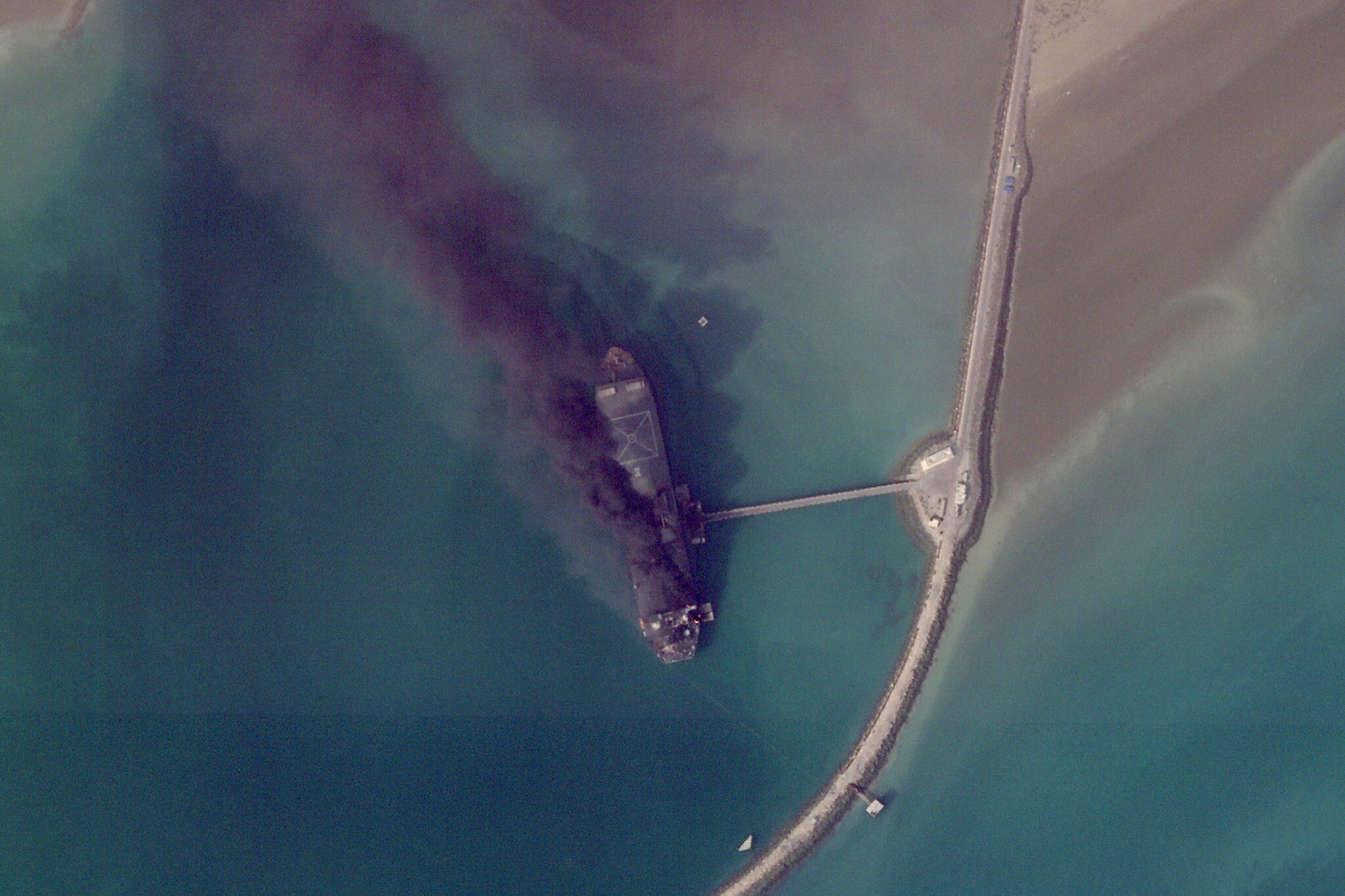
Some of the most dramatic images from Planet Labs so far have been in Bandar Abbas, home to a major Iranian military port next to the crucial Strait of Hormuz connecting the Persian Gulf to the Arabian Sea.
Images taken on March 2 show ships ablaze at the port. The US military’s Central Command has been targeting Iran’s naval assets and says it has sunk or damaged more than 100 Iranian vessels so far in the war.
Major impact at 5th Fleet headquarters in Bahrain
The island kingdom of Bahrain, home of the US Navy’s 5th Fleet, has seen heavy Iranian fire targeting both military bases and oil installations.
A March 1 image shot by Planet Labs shows a major building at the base as well as two radomes — geodesic domes covering radar antennas — destroyed, likely by Iranian missile and drone fire.
The US Navy has not offered a clear breakdown of the damage done so far at the base, but Iran has repeatedly claimed to have attacked it. Online videos have also shown incoming fire targeting the base.
During the 12-day war in June, Iran attacked and destroyed a similar radome at Al-Udeid Air Base in Qatar, used for secure communications.
French naval base hit in Abu Dhabi
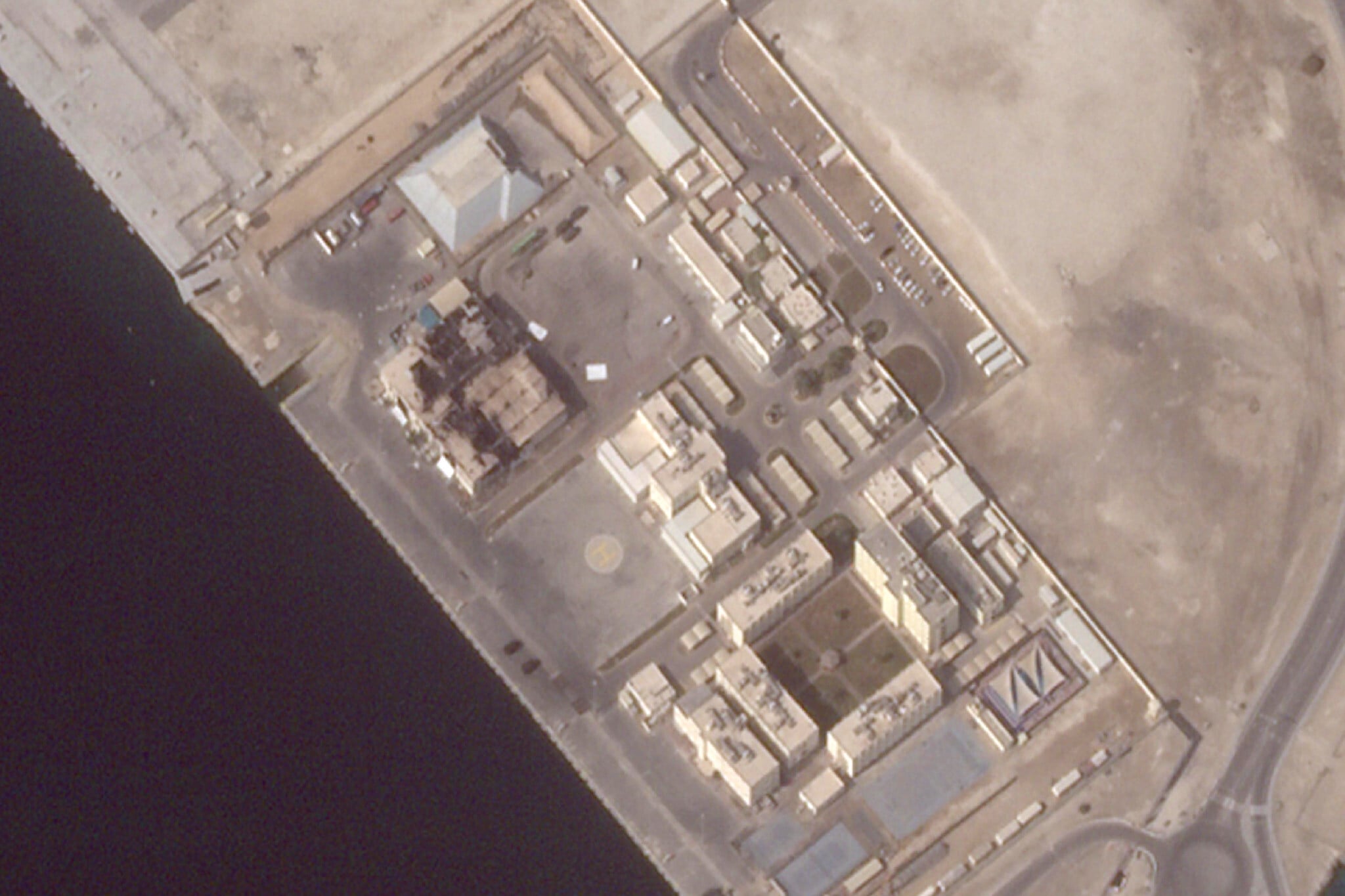
In Abu Dhabi, the capital of the United Arab Emirates, there’s damage seen at France’s Camp de la Paix naval base.
Satellite images from March 3 show damage to two large hangar-like buildings at the facility.
The base is near Zayed Port, in Abu Dhabi, and close to its Cultural District that includes the Louvre Abu Dhabi and other major museums, some of which are open while others are still under construction.
Fires seen burning
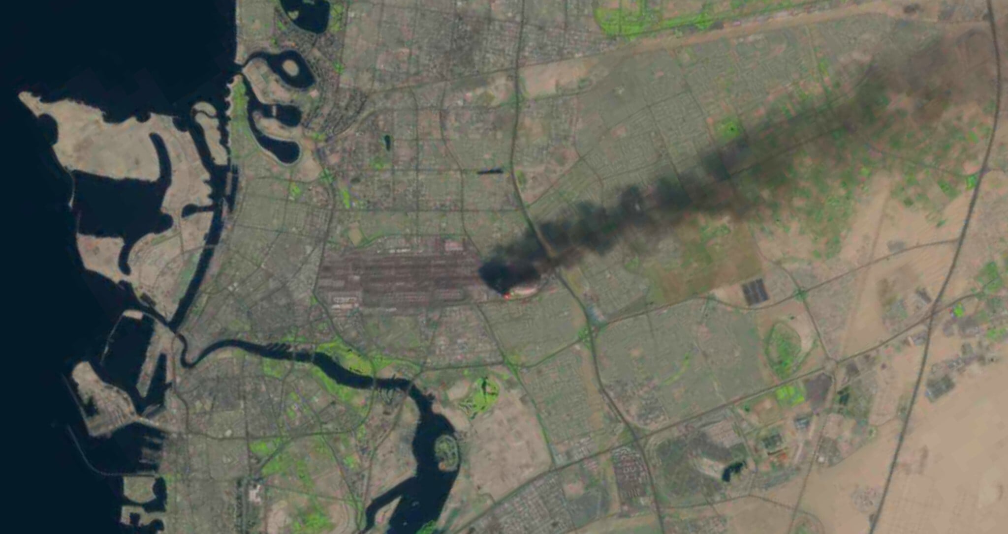
The US Geological Survey’s Landsat satellites have also been key in spotting major fires.
Imagery from Landsat taken on Monday showed a fire at Dubai International Airport, the world’s busiest airport for international travel, after an Iranian drone strike set a fuel tanker ablaze, causing a plume of noxious black smoke.
Another fire was also seen on Monday at Oman’s southern port in Salalah, which came under attack from suspected Iranian drones on March 11, though Tehran has denied it launched them in its campaign targeting Gulf Arab states.
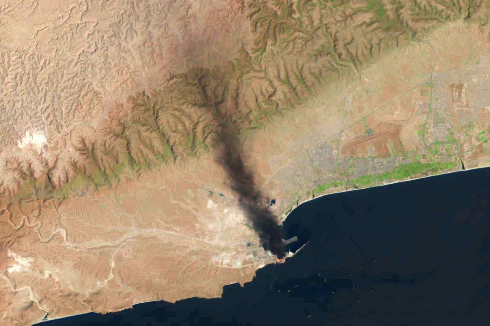
The fire apparently has been burning since then.








The Times of Israel Community.