

Live Update  From the Liveblog of
Sunday, April 19, 2026
From the Liveblog of
Sunday, April 19, 2026
From the Liveblog of
Sunday, April 19, 2026
IDF unveils map of forward defense line in southern Lebanon amid ceasefire
 Add ToI as a Preferred Source on Google
Stav Levaton is a military reporter for The Times of Israel
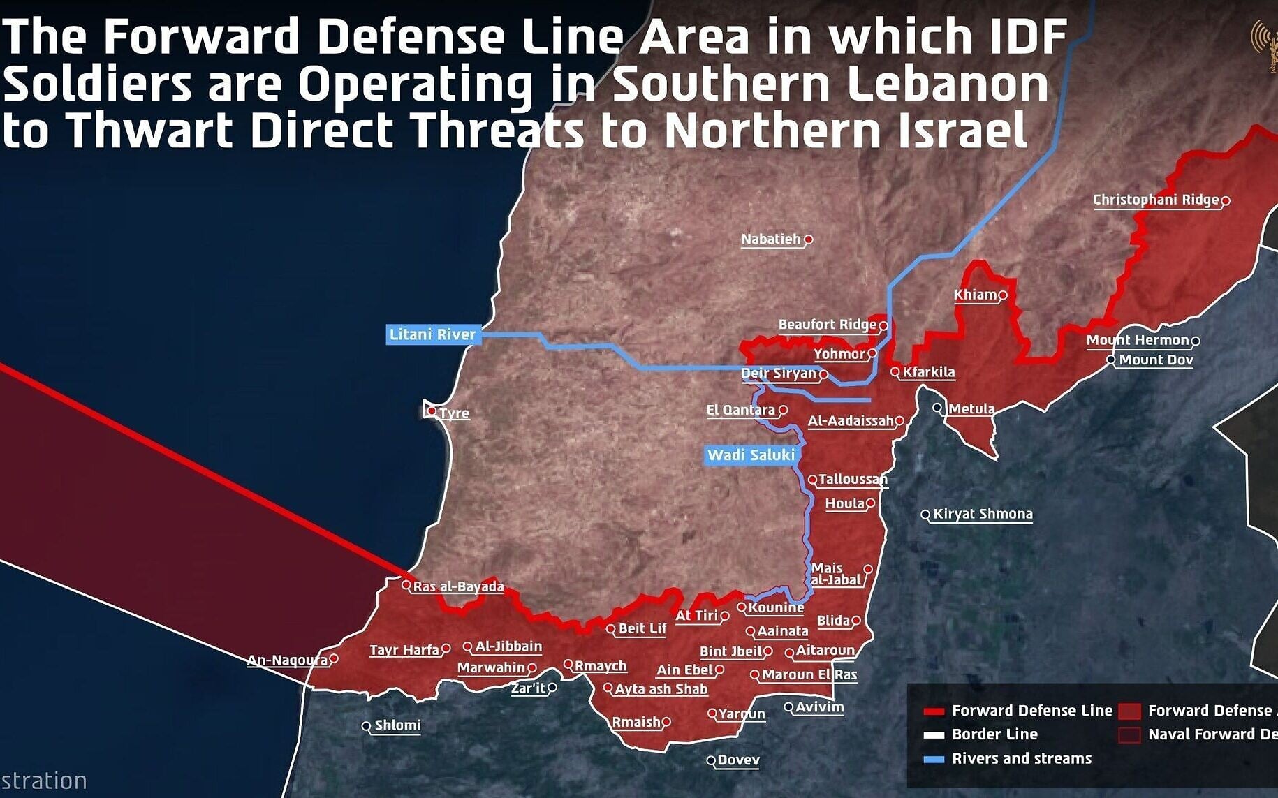
A map published by the IDF, showing its forward defense line in southern Lebanon, April 19, 2026. (Israel Defense Forces)
The IDF publishes a map outlining its new forward defense line in Lebanon, as its forces maintain a presence in the country’s south amid a fragile 10-day ceasefire.
The military says five IDF divisions, alongside naval forces, are operating south of the line to dismantle Hezbollah infrastructure and prevent threats to northern Israeli communities.
The map shows that the security zone crosses the Litani River, a key geographic marker long associated with efforts to push Hezbollah forces northward, and includes the historically strategic Beaufort Ridge.









If you’d like to comment, join
The Times of Israel Community.
The Times of Israel Community.
JOIN THE TOI COMMUNITY
Already a member? Log in here