Paintings of a map that replace Israel with Palestine were displayed at an exhibit in Lebanon funded by a Norwegian NGO.
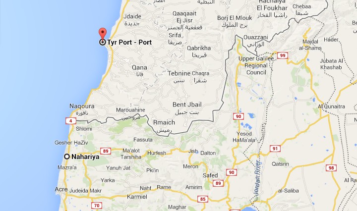
Funders of the Norwegian People’s Aid NGO, which put on the recent exhibit at a refugee camp next to Tyre, include the Norwegian government, the Canadian International Development Agency and other international donors, according to Palestinian Media Watch.
A 2012 annual report also said that the NGO was funded by the US State Department, USAID-US Agency for International Development, the European Union and the United Nations, the Dutch and Swedish ministries of foreign affairs, Germany and other governments.
The exhibit at the Al-Burj Al-Shamali camp was titled “This is Palestine” and the maps were painted by Palestinian children from Lebanon.
On one map, the text gives the area of Palestine as 27,009 square kilometers, which includes all of Israel. Another map shows the borders of Palestine as the Mediterranean Sea, Lebanon, Syria, Jordan and Egypt, while another displays the cities of Palestine identifying Israeli cities and towns.
Get The Times of Israel's Daily Edition
by email and never miss our top stories
By signing up, you agree to the
terms
Help us report truthfully on social media

As a multimedia journalist, my job is to take the quality, fact-based journalism produced by The Times of Israel newsroom and make it accessible across every platform — from Instagram posts to podcasts to short-form videos.
This is how many, especially young people, consume news these days. But misinformation is rampant on social media. Our team at ToI produces accurate, responsible short-form reporting on Israel and the Jewish world.
If you believe in the importance of factual social media journalism, please consider joining our reader support group, The Times of Israel Community. Your financial support is essential to sustain responsible multimedia reporting.
— Gabriella Jacobs, multimedia journalist
Support our work
Support our work
Already a member? Sign in to stop seeing this
You're a dedicated reader

We’re really pleased that you’ve read X Times of Israel articles in the past month.
That’s why we started the Times of Israel - to provide discerning readers like you with must-read coverage of Israel and the Jewish world.
So now we have a request. Unlike other news outlets, we haven’t put up a paywall. But as the journalism we do is costly, we invite readers for whom The Times of Israel has become important to help support our work by joining The Times of Israel Community.
For as little as $6 a month you can help support our quality journalism while enjoying The Times of Israel AD-FREE, as well as accessing exclusive content available only to Times of Israel Community members.
Thank you,
David Horovitz, Founding Editor of The Times of Israel
Join Our Community
Join Our Community
Already a member? Sign in to stop seeing this


 Add ToI as a Preferred Source on Google