

Interactive map charts Shoah deportations of French youth
Some 11,400 children were among the 76,000 Jews deported from France and sent to Nazi death camps
 Add ToI as a Preferred Source on Google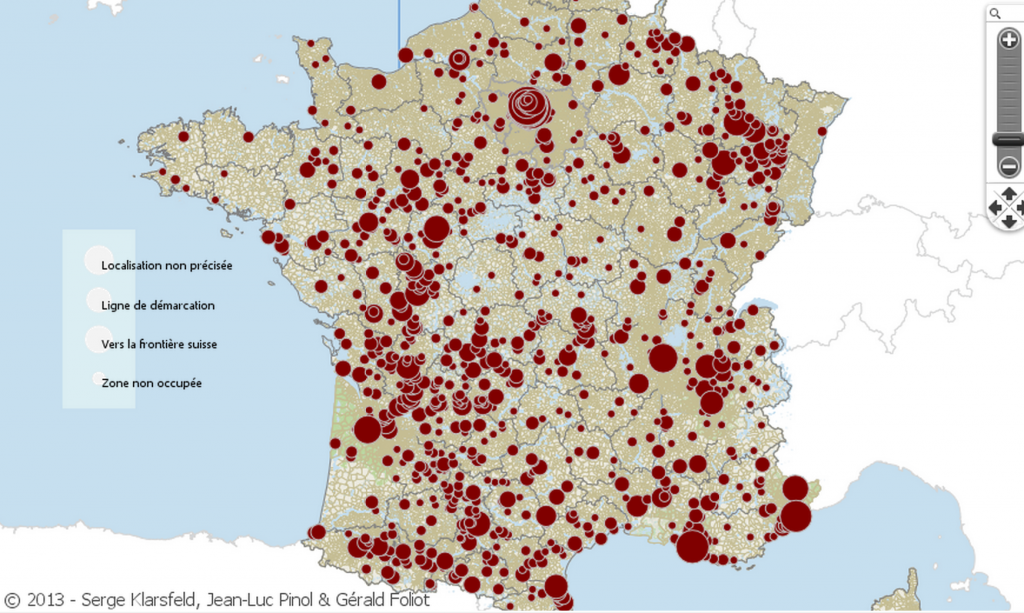
Screen shot of the new interactive website charting the deportation of Jews from France. (screenshot http://tetrade.huma-num.fr/Tetrademap_Enfant_France/)
A French historian has created an interactive map that charts the location of children deported from France during the Holocaust.
On Monday, the online map by Jean-Luc Pinol was so overloaded with connections that it could not be accessed.
Based on data collected by Nazi hunter Serge Klarsfeld, the map is part of an exhibit on display outside the National Conservatory of Arts and Crafts in Paris.
Some 11,400 children were among the 76,000 Jews deported from France and sent to Nazi death camps between July 1942 and August 1944.
On the map, red circles indicate from where the children were deported. Zooming in on the circles shows the exact location where a child was arrested and taken for deportation.










read more:
If you’d like to comment, join
The Times of Israel Community.
The Times of Israel Community.
JOIN THE TOI COMMUNITY
Already a member? Log in here